

Williamsburg, Brooklyn
Commercial - 2003
Social History written on the Landscape
The buildings, the architecture, found throughout Williamsburg carry characteristics of its changing social and political life. A life which has evolved as a by-product of its proximity to Manhattan. This proximity is evident at its waterfront. A waterfront, which has been waiting for a plan which, would invite people from all Boroughs to come and visit Williamsburg.
The Community Boathouse Program and Site offers this unique opportunity. Beyond the site offering a visual connection to Manhattan, it offers a physical connection on the very part of the Landscape, which divides the two places. Here the Water that divides becomes the Ground in which the projects main program activity of rowing requires.
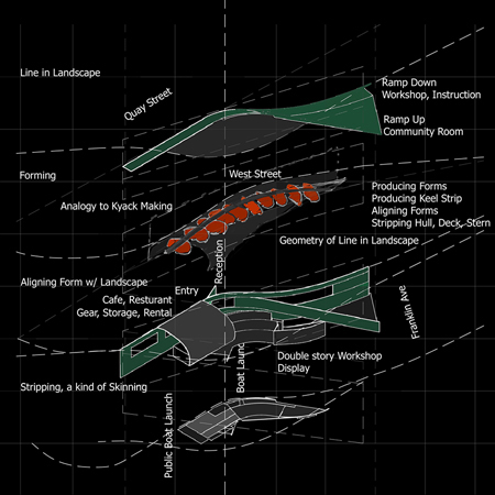
Building Continuity with A Line in the Landscape, Site:
Ground, Water, and Water's Edge
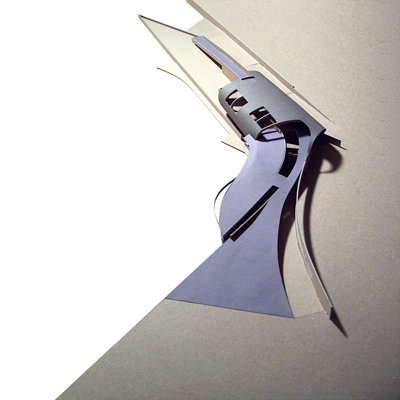
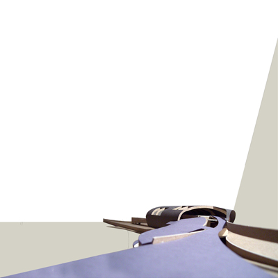
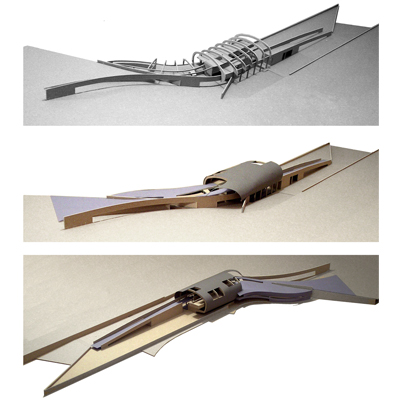
In this design the relationship between building and ground, or edge of architecture and the edge of the landscape is physically, conceptually, and programmatically developed to act as a continuous spatial experience. Instead of defining edge of architecture and landscape, a continuous 3dimensional Line is drawn on the landscape defining the Program from Franklin Avenue into the Inlet, incorporating Quay and West Street. The Line is constructed by using the Analogy to making the kayak as a kind of guide. A kayak is made by:
A.producing its forms,
B.producing its keel strip in which the forms are aligned, and
C.stripping its hull, shear, deck, and stern.
These primary three actions of:
Forming (the Line of the Program),
Aligning (forming of the Line with the Landscape), and
Stripping (a kind of skinning the Form)
construct this Line in this Landscape.
Geometry of the Line in the Landscape
Bushwick Creek Inlet culminates at two-city planning grid geometries found within Williamsburg. The North part of the Inlet is almost parallel to the “page”, ending with Quay Street at West Street. This geometry is also parallel to Flushing Ave., which ends Williamsburg from the grid of adjacent Brooklyn neighborhood. The grid south of the Inlet rotates itself “x” degrees clockwise towards Manhattan and makes a parallel connection to Williamsburg Bridge. The Inlet itself is a product of the two grids and contains the instructional launch, which makes for good practice area.
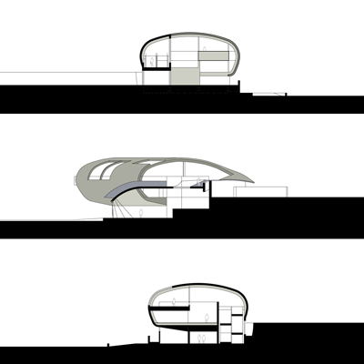
Program Organization
As one approaches the site from Franklin Street, you are confronted with the ramp line up to Café/Restaurant and the ramp line down which engages the water. On this water level, the workshop, the instructional areas, the launch, and offices exists. If one approaches the site from West Street, one is greeted by the fold out arm, which is central to the main circulation ramp, the community room, and the overlook to workshop.
Future Site Development
The remaining site as defined should be developed to include additional public amenities. There is the need for preservation of Williamsburg history, which means a call for a Museum. There is also a need for preservation of site nature and animal life, which would mean a call for a living museum. In the end, the future site program should include community involvement and economic benefits to Williamsburg’s’ future.